Unlocking the Power of Wind: A Comprehensive Guide to Wind Resource Assessment


What is Wind Resource Assessment?
Wind Resource Assessment is the process of evaluating the potential for generating wind energy at a specific location. It involves collecting and analyzing data on wind speed and direction to determine if the location is suitable for installing wind turbines.
How does it work?
Data Collection:
Devices like anemometers (to measure wind speed) and wind vanes (to measure wind direction) are set up at the site.
Tall structures equipped with these instruments gather data at various heights.
Tools such as LIDAR (using light) and SODAR (using sound) can also measure wind speeds at different altitudes, read more on the tools below.
Data Analysis:
The collected data is analyzed to understand the average wind speed, how often different wind speeds occur, and the main wind directions.
This information helps create a wind profile of the site.
Site Suitability:
Factors like the landscape (hills, valleys), nearby buildings, and trees are considered to understand how they might affect wind flow.
The potential impact on wildlife and local ecosystems is also assessed.
Energy Production Estimates:
Using the wind profile, experts estimate how much electricity wind turbines could generate at the site.
Why is it important?
Maximizes Efficiency:
By choosing the best locations with the strongest and most consistent winds, wind turbines can generate more electricity efficiently.
Economic Viability:
Accurate assessment helps in determining if the investment in wind energy at a particular site will be profitable. It helps investors make informed decisions.
Reduces Risks:
Identifying potential issues like low wind speeds or environmental impacts early on helps in mitigating risks and avoiding costly mistakes.
Informs Design and Placement:
Understanding wind patterns allows for the optimal design and placement of wind turbines, enhancing their performance and longevity.
Supports Sustainable Development:
Wind resource assessment is crucial for developing reliable and sustainable wind energy projects, contributing to the reduction of greenhouse gas emissions and reliance on fossil fuels.
Key Concepts
Average Wind Speed refers to the mean wind speed measured over a specific period, usually over several months or years. This metric is crucial as it helps determine the potential energy output of a wind turbine at a given location. Higher average wind speeds typically translate to more energy production, making this an essential factor in evaluating a site's suitability for wind energy. However, it's important to note that average wind speed alone doesn't provide a complete picture, as the variability of wind speeds also significantly impacts energy production.
Wind Speed Distribution represents the frequency at which different wind speeds occur at a specific location over time. This concept is vital for accurately predicting the energy yield of wind turbines. Wind turbines generate electricity more efficiently at certain wind speeds, so understanding the distribution of wind speeds helps in making precise energy production forecasts. Additionally, wind speed distribution aids in selecting the appropriate turbine model for a site, ensuring that the turbines operate efficiently within the expected wind speed range.
Wind Roses are graphical representations that show the frequency and direction of winds at a particular location. These diagrams are circular, with each segment representing wind blowing from a specific direction, and the length of each segment indicating the frequency of winds from that direction. Wind roses often include information about wind speed distribution for each direction. They are essential for determining the optimal orientation and placement of wind turbines to capture the most wind. Moreover, wind roses assist in designing the layout of a wind farm to minimize wake effects, where turbines downstream of others receive less wind.
Considerations
Topography, which refers to the physical features of the land, including hills, valleys, and flat plains, plays a significant role in wind resource assessment. The shape and elevation of the land can accelerate or decelerate wind speeds and create turbulent conditions, affecting turbine performance. Elevated areas often experience better wind speeds, while valleys might have reduced or turbulent winds. Therefore, understanding the topography of a site is crucial for optimal turbine siting.
Land Use involves considering how the land is currently utilized, including the presence of buildings, vegetation, and other infrastructure. Buildings and trees can obstruct wind flow, causing turbulence and reducing wind speeds, which impacts turbine efficiency. Additionally, the land must be compatible with wind turbines without conflicting with existing land uses, such as agriculture or residential areas. Proper assessment ensures that wind energy projects can coexist with other land uses without significant disruption.
Environmental Impacts assess the potential effects of wind energy development on the local environment, wildlife, and ecosystems. Wind turbines can pose risks to birds and bats, making it essential to mitigate these impacts through proper siting and design. The construction and operation of wind farms can also affect soil, water, and local plant life, necessitating careful evaluation to ensure sustainable development. Compliance with environmental regulations and obtaining necessary permits are critical steps in this process, ensuring that wind energy projects are both environmentally responsible and legally sound.
Tools and Methods Used
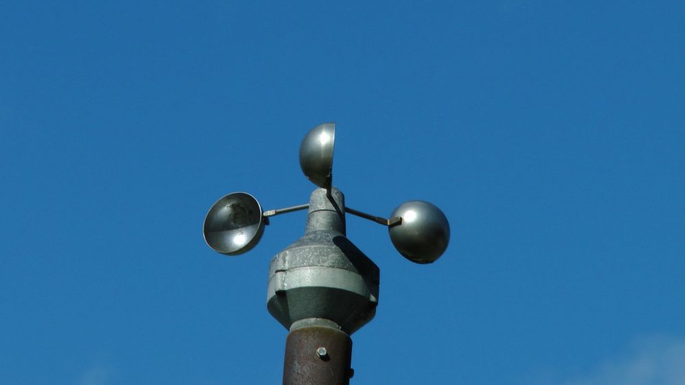
1. Anemometers are devices used to measure wind speed. They come in various types, but the most common is the cup anemometer.
How They Work:
Cup Anemometer: It consists of three or four cups attached to horizontal arms mounted on a vertical shaft. As the wind blows, it pushes the cups, causing the arms to rotate. The speed of rotation is proportional to the wind speed.
Sonic Anemometer: Uses ultrasonic sound waves to measure wind velocity. It has no moving parts and can provide precise measurements of wind speed and direction.
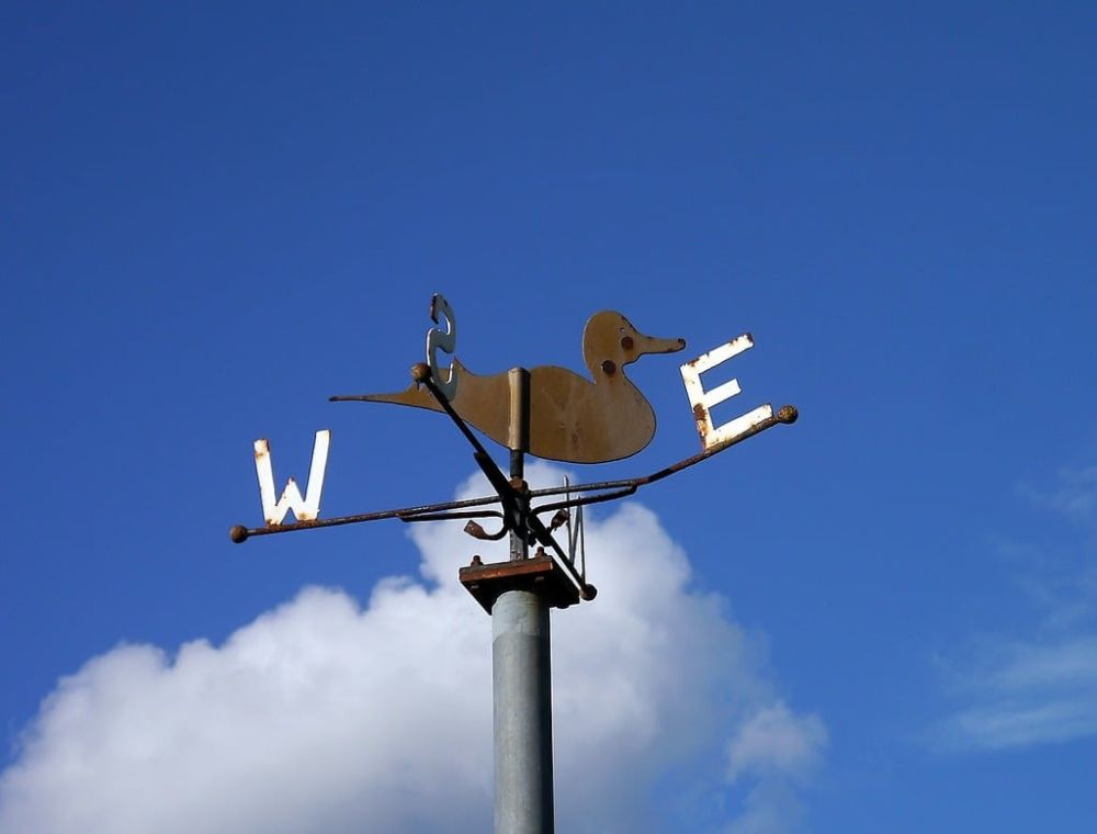
2. Wind vanes, also known as weather vanes, are instruments used to determine wind direction.
How They Work:
They consist of a rotating arrow or a similar shape mounted on a vertical rod. The arrow points in the direction from which the wind is coming. The device is usually mounted on top of meteorological towers or buildings to get unobstructed wind measurements.
3. Meteorological Towers are tall structures equipped with various instruments to measure weather conditions, including wind speed and direction at different heights.
How They Work:
These towers, often ranging from 10 to 120 meters tall, have anemometers and wind vanes mounted at different levels. The data collected provides a detailed vertical profile of wind conditions over time. The towers are strategically placed to avoid obstructions and to represent the site's wind characteristics accurately.
4. LIDAR (Light Detection and Ranging) is a remote sensing method that uses laser light to measure wind speed and direction at different altitudes.
How It Works:
A LIDAR system emits laser pulses into the atmosphere. These pulses are scattered back by particles in the air (like dust or moisture). The system then measures the time it takes for the light to return and the change in wavelength caused by the Doppler effect to calculate wind speed and direction at various heights. LIDAR can provide detailed wind profiles without the need for tall towers.
5. SODAR (Sonic Detection and Ranging) is another remote sensing technology that uses sound waves to measure wind speed and direction at different heights.
How It Works:
SODAR systems emit sound pulses into the atmosphere. These pulses are scattered back by temperature fluctuations and turbulence in the air. By analyzing the returned sound signals and the Doppler shift, SODAR can determine wind speed and direction at various altitudes. SODAR systems are portable and can provide continuous, real-time data.
Case studies
Hornsea One, UK, operated by Ørsted, is the world’s largest offshore wind farm, with a capacity of 1.2 GW. Before its development, a comprehensive wind resource assessment was conducted using a combination of meteorological masts, LIDAR systems, and advanced computational modelling. These assessments provided detailed data on wind speeds and patterns at various heights and locations across the proposed site. The wind resource data revealed that the site had an average wind speed of around 10 meters per second at the turbine hub height, which is ideal for wind energy production.
The detailed wind speed distribution analysis allowed the project developers to optimize the placement and orientation of the turbines to maximize energy capture and minimize wake effects. As a result, Hornsea One is expected to generate over 4 TWh of electricity annually, enough to power more than one million homes. The project's success underscores the importance of accurate wind resource assessment in maximizing energy production and ensuring the financial viability of large-scale wind projects.
Alta Wind Energy Center (AWEC) in California, USA isone of the largest onshore wind farms in the world, with a capacity of over 1.5 GW, underwent an extensive wind resource assessment during its planning stages. The assessment included the use of multiple meteorological towers and advanced modelling techniques to map the wind resources across the expansive site, which covers over 3,200 acres.
The data collected indicated significant wind resources, with average wind speeds exceeding 8 meters per second. This information was crucial in optimizing turbine selection and placement, resulting in high efficiency and productivity. The comprehensive wind resource assessment enabled the developers to predict energy production accurately, leading to an estimated annual generation of 4.5 TWh. This output is sufficient to power approximately 450,000 homes and has made AWEC a key contributor to California’s renewable energy goals. The project’s success has also demonstrated the economic benefits of investing in thorough wind assessments, with AWEC becoming a model for future large-scale wind energy developments.
In Denmark, the Horns Rev 2 offshore wind farm highlights another successful application of wind resource assessment. With a capacity of 209 MW, Horns Rev 2 underwent rigorous assessment using meteorological masts and LIDAR technology to gather detailed wind data over the North Sea. The analysis revealed optimal wind conditions, with average wind speeds of about 9.5 meters per second. This data was instrumental in the strategic placement of the 91 wind turbines, ensuring maximum exposure to consistent wind flows.
The accurate wind resource assessment allowed for precise energy yield predictions, resulting in an annual production of approximately 800 GWh, enough to power around 200,000 households. Horns Rev 2’s success showcases the critical role of detailed wind assessments in achieving high operational efficiency and meeting energy production targets. The project has also contributed valuable insights into the benefits of offshore wind farms, reinforcing the importance of accurate site assessments in the growing offshore wind sector.

Challenges
The variability and complexity of wind patterns make it difficult to capture accurate data, as wind speeds and directions can change rapidly due to local topography and atmospheric conditions. This requires extensive, continuous data collection, often over several years, which can be costly and resource-intensive.
Site accessibility is another major issue. Ideal locations for wind farms, such as offshore sites or mountainous areas, can be difficult and expensive to reach. Installing and maintaining data collection equipment in these locations can be logistically challenging, and harsh environmental conditions can impact the reliability of these instruments.
Data accuracy and resolution are crucial for precise modelling and prediction. High-resolution data requires advanced equipment and sophisticated analytical methods. Ensuring accuracy, especially from remote sensing technologies like LIDAR and SODAR, involves complex calibration and validation processes.
Environmental and regulatory considerations also add complexity. Assessing potential impacts on wildlife and ecosystems, and navigating regulatory requirements, can be time-consuming and may involve significant stakeholder engagement and environmental impact assessments.
Emerging Trends and Future Prospects
Emerging trends in wind resource assessment focus on improving data accuracy, reducing costs, and enhancing predictive capabilities. The increased use of advanced remote sensing technologies like LIDAR and SODAR is notable. These technologies are becoming more accurate, portable, and easier to deploy, making them suitable for a wider range of sites, including challenging offshore locations.
The integration of big data analytics and machine learning is another promising trend. These techniques process vast amounts of wind data to identify patterns and improve predictive models, reducing uncertainty and optimizing turbine placement and performance.
Hybrid assessment approaches that combine data from traditional meteorological towers with remote sensing and advanced modelling are becoming more common. This method leverages the strengths of different techniques to provide more accurate and reliable assessments.
Floating LIDAR systems are expected to play a crucial role in offshore wind resource assessment. These systems, deployed on floating platforms, provide high-resolution wind data in deep-water locations where fixed towers are impractical, expanding potential sites for offshore wind farms.
The development of digital twins, virtual models of wind farms that simulate real-world conditions, is another exciting prospect. Digital twins integrate real-time data from turbines and environmental sensors to optimize operation and maintenance and improve planning for future projects.

Cut through the green tape
We don't push agendas. At Net Zero Compare, we cut through the hype and fear to deliver the straightforward facts you need for making informed decisions on green products and services. Whether motivated by compliance, customer demands, or a real passion for the environment, you’re welcome here. We provide reliable information. Why you seek it is not our concern.